We packed up and set off at 7:30 in the morning with good weather. We warmed up with a walk up the valley towards Rabbit Pass before we started a slow ascent out of the river bed following the orange route markers. The route was steep and the going was slow. We stopped a couple of times to munch on bars and catch our breath. Eventually, we left the tussocks and started climbing a steep rocky section towards the ridge. There were big slabby rocks sitting on scree that moved disconcertingly as you stood on them. We had our helmets on though so surely that would make things safe? Gina didn’t have her helmet so naturally went last… allowing us to push rocks down on her… Ooops.
Anyway, after some careful foot work we all made it safely to the ridge. By this point we were above the pass so we walked along the ridge descending slightly to a spot for lunch. This was followed by a couple of kilometres walking along the flat pass with larger mountains on either side. The pass would make a nice place to camp if you had the right weather with plenty of grassy patches.
")
")
Above left: We had some loose rocks to contend with on the way up Rabbit Pass but we all made it to the top safely. Leonie is bleeding only slightly. Above right: We did some posing before dropping down to the pass proper.
Above: We left Ruth Flat in the morning and picked our way up a river on the true left before heading further to our right and coming out above Rabbit Pass. We then walked over to the flat 2 km long-ish pass.
After a little while we arrived at the waterfall and crux for the day. The river drops down a 90m drop followed by another 35 m waterfall and the route descends 200 m from a higher point to the true left of the river. We stopped before the descent and surveyed the route from the edge. It was extremely exposed. The descent begins with a sidle/climb across very steep terrain. A wrong foot would lead to a roll down a very run-out slope to the edge of the cliff before a fall to its base. It would be a freak accident if you survived.
With this in mind Kieran climbed down to the first route-pole and took a look at the rest of the descent. He climbed back and reported that he thought the first bit was the crux. Gina and pack set off followed by the others and they gingerly climbed down to the next route marker. Leonie and I started both with packs on but I soon decided it would be better if I headed down first and that Leonie climb without her pack. The first few moves were like a very easy rock climbing route albeit with a mix of dubious snow grass hand holds and the occasional rock that may or may not be well attached. If the exposure hadn’t been there you wouldn’t think twice about it however with the thought of slipping to certain doom it made you focus on each foothold and handhold.
I dumped my pack at the next marker and went back up to Leonie who had started climbing again without her pack. She made it down to where the others were waiting with Gina who met us halfway along and I went back to the top and collected her pack.
We then spent another hour or so clambering down to the bottom on a mix of rock and grass. It was generally less exposed however you still wouldn’t want to slip with a high chance of breaking something (or things) if you did.
Leonie did a very good job of getting down although clearly wasn’t that happy about the descent… but then I don’t think anyone enjoyed it.
")
")
Above left: After some scouting out the route we descended the horribly exposed Rabbit Pass. If you slipped due to a wrong footing or a dodgy handhold you’d certainly fall to your death. This is the waterfall section. The other side of the pass is much tamer. Most people go up here because it’s easier… Above right: Leonie did an excellent job picking her way across the steepest most exposed section to begin with until she got to the more gentle slopes shown here.
Due to the exposure, the route should definitely not be attempted if the grass is at all wet… this would be plain stupid.
From the bottom we spent another few hours walking down to Top Forks hut where we camped the night. The hut was full so we lazed outside on the grass and cooked some of the ridiculous fresh vegies I was still carrying.
Above: The descent was very steep. The first part was extremely exposed, which unfortunately also means that I don’t have any videos or photos of it.
Above: After a stop at the first marker pole we continued descending on a milder slope.
Above: It wasn’t super easy going though.
Above: You’d probably survive a fall here! Probably…
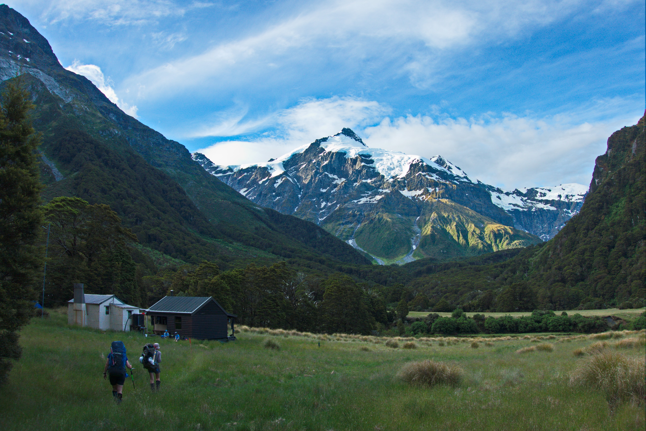
Above: We arrived at Top Forks Hut in the evening and cooked dinner outside on the grass.
Here’s what the map looked like:
View Larger Topographic Map
admin
11 Apr 2015test
admin
11 Apr 2015Oooh comments finally work again… Not sure exactly when that broke… but knock yourselves out please. Comment away. 🙂
admin
17 Jan 2016This blog entry was quoted on this recent accident on Rabbit Pass.
https://cris.lovell-smith.com/trips/wp-content/uploads/2014/12/Wanaka-police-refer-Rabbit-Pass-accident-to-coroner-_-Stuff.co_.pdf