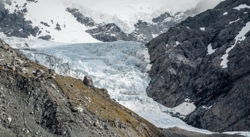
After spending a day in the hut in torrential rain the weather had cleared. We headed off early in the morning towards Gillespie Pass, but then took a short detour across the valley where we dropped our packs and headed up to Crucible Lake. It was well worth the 600 m climb. The lake was filled with icebergs and two inquisitive keas joined us as we arrived.
Above: There were two very friendly keas at the lake.
Above: I was able to sit about 10 cm away from this fellow.
Above: I went for an adventure out onto the ice.
We then headed back down to the valley, collected our packs and walked over Gillespie Pass and down to the Young Hut. We had a quick 2 minute noodle cook up at the full hut and headed further down the valley to the Young Campsite where we camped the night by the river.
")
")
Above left: On New Year’s Day we headed up to Crucible Lake in the morning and was greeted by this guy at the top. Above right: We were also greeted by this awesome view of the lake. The icebergs were bobbing happily in the water. I tried my luck and floated on one for a bit avoiding falling into the cold water.
")
Above: We headed down from the Crucible Lake and up to Gillespie Pass stopping somewhere along the way for lunch. Then we descended steeply into the south branch of the Young River before walking out to the Young Hut.
Above: After five days tramping I was still carrying fresh food.
")
")
Above left: Young Hut was full when we arrived so we sat on the deck and cooked up a quick two-minute noodle feast before heading further down the valley to the Young Forks Campsite, where we pitched our tents by the river for the night. Above right: New Zealand is very pretty.
And the map, at least the bit from Crucible Lake to the Young Forks Campsite. Despite what it looks like, we didn’t jump across the lake when we left. Apparently my GPS did though…
View Larger Topographic Map